
Walk a Thurston Street Record
A useful street-by-street search separates owners from occupants. Thurston County's Assessor identifies the owner or taxpayer linked to a parcel, while the Auditor's recorded deed confirms the instrument behind a transfer. Neither record proves who sleeps at the address today. A dated directory entry or a lawfully obtained voter-list field may support occupancy for a particular time, but it can miss nonvoters, moves, protected records, and unlisted household members.
- Enter the number and street name in the Assessor A+ Parcel Look-Up. Save the parcel number, situs address, owner label, and result date.
- Open the same address in GeoData. Select the parcel itself, then record its municipality, ZIP, boundary, and any separately selected nearby parcels.
- Use the Auditor Document Search with the owner name, Auditor File Number, or map reference. Read the document type and indexed parties before drawing a conclusion.
- If election context is needed, follow the Auditor Elections data-request route. VoteWA is personal self-service, not a search for someone else.
- For an older household, check a matching directory year, census, newspaper, or Sanborn map and keep the date beside every name.
This sequence turns the Thurston County street directory into a set of checks rather than a name dump. If the goal changes from a whole road to one historic property, the previous residents research path follows that address backward.
Search Thurston Streets in A+
The Assessor A+ Parcel Look-Up accepts an address or a street name alone. County instructions say to omit street type and direction for the street-name option, so a search uses the core name rather than adding words such as Way or SE. A complete-address attempt should still preserve the source spelling. Sort the results by owner name, address, or parcel number, then double-click the property number to inspect the record.
| A+ field | Entry | Use in a street search |
|---|---|---|
| Parcel number | 11 digits | Returns one known tax parcel |
| Last name or organization | Name text | Finds the owner or taxpayer label |
| First name | Name text | Narrows a person-name result |
| Situs street number | Number | Pairs with the street name |
| Situs street name | Core name | Finds parcels along the road |
| Sort order | Owner, address, parcel | Groups results for review |
The captured A+ search screen shows these fields as they appeared during research.
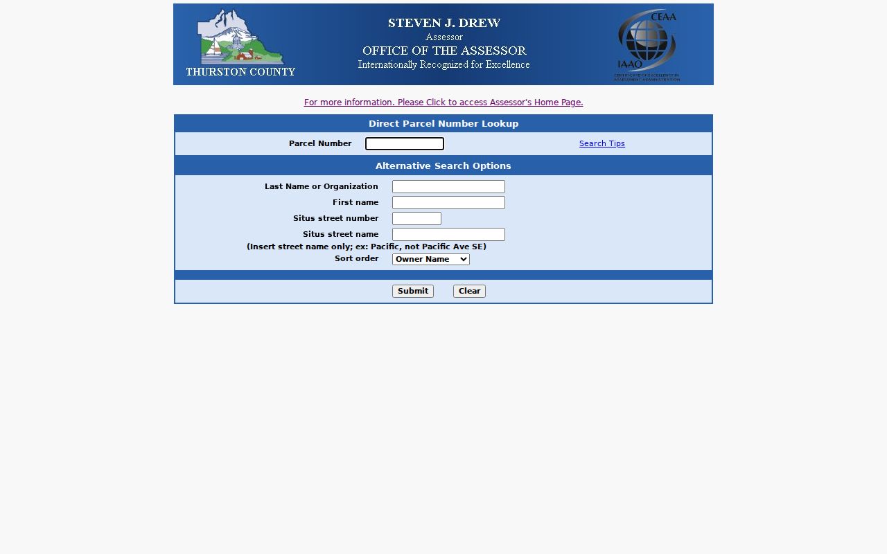
That screen is the strongest current owner lead for this address workflow, not a certified statement of title or occupancy.
Thurston Records Keyed by Address
Several official systems can answer different questions about the same Thurston County street. Their fields do not mean the same thing. A situs address locates the parcel, a mailing address reaches the taxpayer, and a legal description identifies land without relying on a modern street label.
| Address source | Custodian | Useful result | Access route |
|---|---|---|---|
| Assessment record | Thurston County Assessor | Owner lead, parcel, situs, property facts | A+ online; Assessor request for other records |
| Parcel map | GeoData Center | Boundary, municipality, ZIP, layers | Online map; phone, email, or office help |
| Recorded instrument | Thurston County Auditor | AFN, document type, indexed parties | Online index; office, phone, email, or mail copies |
| Voter data | Auditor Elections | Lawfully public, dated registration fields | Regulated data request at actual reproduction cost |
| Municipal record | Relevant city | Permits or code records held by that city | City request center or named custodian |
A+ handles ordinary ownership, location, characteristics, legal descriptions, and sales without a formal disclosure request. Deeds, maps, surveys, easements, mortgages, plats, and boundary-line adjustments belong with the Auditor. Permitting jurisdiction depends on whether GeoData places the parcel in Olympia, Lacey, Tumwater, another incorporated city, or unincorporated county.
Map Thurston Streets Parcel by Parcel
GeoData adds the spatial view that a text street directory lacks. Search the Thurston property map by address or parcel, choose the returned point, zoom, and click until the parcel outline is highlighted. The left panel can show the owner label, parcel number, address, ZIP, and city status. Select each adjacent polygon on its own. The county did not document an automatic resident-radius tool, so a drawn rectangle must not be described as an official neighbor list.
The Show Me Everything viewer also offers jurisdiction, urban growth area, zoning, shorelines, wetlands, steep slopes, parks, fire districts, roads, utilities, and other layers. Those layers describe county GIS observations. They do not decide title, a boundary dispute, or engineering facts. Use the bold parcel-number link and partial legal description to bridge from the map to an Auditor record.
Map limit. Thurston County describes the viewer as general reference, not survey, legal, or engineering grade.
Thurston Street Record Terms
Four labels prevent common mistakes when a search moves from a road name to the official record.
- Parcel
- A mapped unit of land with its own county identification number. One building may involve more than one parcel.
- Situs address
- The physical location assigned to the parcel. It may differ from the owner's mailing address.
- Plat
- A recorded map that divides or describes land. Named plats and numbered maps use different Auditor search paths.
- Criss-cross directory
- A historical directory arranged by street or telephone number rather than only by surname. Local reverse coverage must be confirmed with the library.
Keep each label in its own column. Combining the situs, postal city, legal description, and historical printed address can hide the exact mismatch that explains a failed search.
Link Thurston Streets to Deeds
The Assessor's owner name is only the start. The Auditor Document Search provides index information for recorded documents and online images for specified classes, including deeds, easements, leases, most maps, covenants, and releases. Inspect the Auditor File Number, recording date, document type, grantor and grantee names, legal description or map clue, and image status. An online image is a standard copy, not a certified one.
The captured Auditor recorder landing page documents the official portal used for this Thurston County street directory.
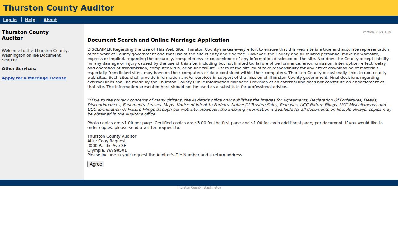
If a public image is absent, all public records remain viewable at the Auditor's office. Copies may also be requested in person, by phone, email, or mail using the AFN. The researched schedule lists $1 per page for photocopies and $3 for the first certified page plus $1 for each added page, so confirm the live page before ordering.
Decode Thurston Map References
A partial legal description may contain a volume and page such as 022/101, which can move a search from GeoData into the Auditor index. Preserve leading zeroes. Use either the AFN or volume and page in the matching search path, not both at once. Named plats are searched by placing the plat name in the Grantor field. Numbered boundary-line adjustments, short subdivisions, large lots, and NPS maps use a Map Case number instead.
Surveys take another route: requester name or section, township, and range, plus the survey document type and quarter or quarter-quarter. This branching is a Thurston-specific reason a valid map can seem missing. Search the kind of identifier printed in the source rather than forcing every reference into the party-name box.
Old Numbers on Thurston Streets
A modern map failure does not prove an old address never existed. Timberland Regional Library's Sanborn map resources cover city and town plans from 1867 through 1970 and can show street blocks, building numbers, and current or previous numbers. Compare a Sanborn sheet with directory editions on both sides of a suspected change, then use the parcel's legal description and recorded map. No official countywide chronology of renumbering and annexation was found, so avoid assigning a change year without a dated source.
Olympia's historic-property workflow connects the Assessor, Auditor, Olympia Timberland Library clipping files and maps, State Archives assessor field books, and Olympia Historical Society resources. Smaller places such as Bucoda, Tenino, Rainier, and Yelm may have thinner directory runs. In those areas, a county census, newspaper, church or cemetery source, and municipal request can fill gaps without pretending that a missing annual directory exists.
Thurston Street Address Mismatches
A parcel may sit inside one city while using another postal city. The county ZIP map is general reference, and GeoData returns a ZIP after parcel selection rather than offering a full ZIP search. Verify the delivery form with the USPS lookup, then keep the GIS municipality, mailing city, county ZIP layer, and directory label as separate values. A PO Box is not the parcel's street location.
This matters across Olympia, Lacey, Tumwater, Bucoda, Tenino, Rainier, Yelm, and unincorporated Thurston County. County Assessor and Auditor records may apply inside a city, while a city permit or code file stays with the municipality. Olympia has an official public-records center; complete verified portals for every smaller city were not found in the research. Ask the named city custodian rather than sending all municipal requests to the county.
Limits of Thurston Street Records
No official current reverse telephone directory or universal household list was located. Property records show an owner or taxpayer, not every person at the door. A voter list excludes many residents and has strict request and use rules. Historical directories are dated snapshots. Apartments may share one assessor address, rural routes may become street numbers, and one parcel may carry several situs addresses. State Address Confidentiality Program records can use a substitute address, while protected real-address information must stay private.
For lawful voter data, contact Thurston County Auditor Elections through its Data and Research page. VoteWA asks a registered voter for a matching first name, last name, date of birth, and CAPTCHA to reach that person's own record. It is not part of a public street-by-street search. Record only the minimum fields needed for family history, property research, civic inquiry, or scam prevention.
Lawful use. Use Thurston County address records for a narrow, lawful purpose. Never use them to stalk, harass, threaten, or expose a protected address.
Fees, hours, portal fields and availability can change. Confirm with the linked custodian; this page is a research guide, not legal advice. Last verified September 3, 2026. Send corrections through the contact page.